Information about LiDAR Data sets for Buzzards Bay
2006 FEMA/CDM LIDAR Data for Bristol and Plymouth Counties
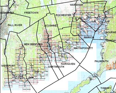
FEMA hired the FIRM Camp Dresser and McKee to collect and evaluate LIDAR (Light Detection and Ranging) data for portions of Bristol and Plymouth Counties along Buzzards Bay. The effort is documented in this 2008 report, Flood Mapping Activities for Plymouth and Bristol Counties, Massachusetts (29 MB). Task Order 18 Activity 1--Topographic Data Development / Acquisition Summary Report. Contract No. EME-2003-CO-0340 Task Order T018. Prepared for: FEMA Region I, February 2008. The LIDAR data was collected in November and December of 2006 by Sanborn Mapping Company and processed in 2007. CDM developed a bare earth TIN (Triangular Irregular Network) Digital Elevation Models based on this data, which was used as the basis for this coverage. In an evaluation of the study area, CDM determined that the root-mean square average difference in elevation for 48 surveyed points as compared to the LIDAR TIN data was 0.52 feet, and this met the FEMA minimum accuracy requirement of 1.2 feet. They concluded, "based on this analysis, this LIDAR data is acceptable for use in H&H analyses [hydrologic and hydraulic] and flood zone mapping." Elevations are NAVD 88 feet. They also prepared 2-foot elevation contours based on this LIDAR data. The Buzzards Bay NEP can provide this data to interested municipal officials and engineers (email us).Although the absolute elevation accuracy averaged only half a foot for the study area, the relative precision of the LIDAR data is less than one inch over small areas. This means that the TIN data can be used to create very narrow elevation contours for a particular site, and this data can be used to evaluate stormwater flow paths. This application is illustrated by the map to the right showing one-half foot contours at piers along the New Bedford waterfront.

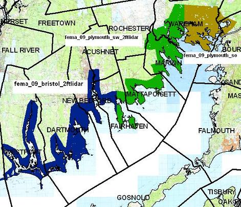
FEMA LIDAR coverages (TIN model and 2 ft contours) available from the BBNEP along Buzzards Bay (click map to enlarge).
2011 USDA/NRCS USGS NE England LiDAR Data
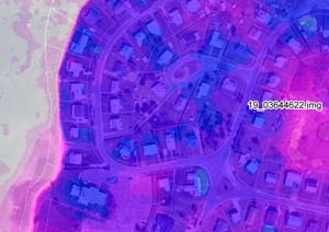
The Northeast LIDAR (NELIDAR) Project is a collaboration between USDA NRCS, USGS, and other agencies to acquire accurate, high-resolution Light Detection and Ranging (LIDAR) data for coastal areas of New York, Connecticut, Rhode Island, Massachusetts, New Hampshire and Maine. The LIDAR data will be processed to produce a classified point cloud, bare-earth elevation models and related products. Information about the effort is available at: www.ma.nrcs.usda.gov/technical/lidar/index.html.Many of the planned areas are complete, and the Buzzards Bay NEP has obtained data for the Buzzards Bay watershed, including those areas on Cape Cod. Our copy of the dataset does not overlap with the FEMA/CDM 2007 survey on the western shore of Buzzards Bay. Our data is available as georeferenced imagine (.img) images. Below is an example image from this data set, and a link to download the image file.

2011 LiDAR image of Buttermilk Way watershed Click image to enlarge
Download this Georeferenced Imagine Format file with elevation data (19_03644622.zip) 9 MB zipped file that can be displayed in ArcView and other programs.
Options to obtain data from the BBNEP
For the entire set of TIN files, point files, and 2 foot contours, send us a portable external drive with at least 50GB capacity, and we will mail it back. If you need just one tile, we will email a link. If you just need two foot contours, download the shape files in the panel to the right (email us if you need more information.)
