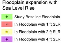
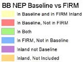
MAP showing Potential Floodplain Expansion with Sea Level Rise
.We analyzed only the western shore of Buzzards Bay in this study because FEMA has not finalized maps for Bourne and Falmouth. Some of the files are large so it may take a minute or two to download with a slow internet connection. Drag the person icon onto the road to get a street view of the area. Click the "x" (top right of the view box) to exit street view mode.


