Data to support the selection of long-term salt marsh monitoring sites
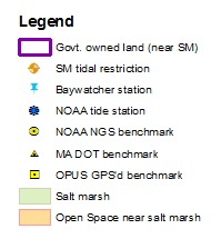
This webpage was set up in support of a long term study of salt marsh loss in Buzzards Bay being undertaken by the Buzzards Bay National Estuary Program, and the Buzzards Bay Coalition. Displayed on this map is information relevant to the study sites. The selected sites are publicly owned or permanently protected and publicly accessible salt marshes and adjacent uplands, with parking relatively close to allow for the porting of survey equipment. The Buzzards Bay NEP, in collaboration with its partners, will install a permanent survey marker (survey monument) in an upland area immediately adjacent to the marsh. A brief overview of the methodology used in this study is contained in this Standard Operating Procedures document. The benchmarks will be used to measure the precise geodetic elevations of features and vegetation within each marsh, and these will be related to tidal datums.

